Introduction
The logistics, freight transportation, and on-demand ridesharing sectors are the backbone of commerce across the Gulf Cooperation Council (GCC). In Saudi Arabia, the sheer geographical expanse connecting Riyadh, Jeddah, Dammam, and Medina demands sophisticated supply chain intelligence. In Oman, vital transit corridors linking Muscat, Sohar, and Salalah require round-the-clock vehicle telematics. Coupled with strict digital tracking mandates from regulatory bodies such as Saudi Arabia's Transport General Authority (TGA / Wasl platform), real-time fleet visibility is no longer an optional feature; it is an operational and legal requirement.
However, developing a production-ready real-time fleet telemetry pipeline is fraught with engineering traps. A naive approach (such as polling GPS coordinates every second and posting them to an HTTP REST endpoint) rapidly drains the driver's smartphone battery, triggers thermal shutdowns on sun-drenched vehicle dashboards, overwhelms database connections with millions of write queries, and presents passengers with jerky, teleporting map markers.
When I architected and built the Apaale and Apaale Driver ecosystem, a comprehensive ridesharing and logistics platform, we engineered a high-throughput, low-latency telemetry infrastructure from the ground up. The system required:
- Continuous background vehicle telemetry with zero dropped packets.
- Adaptive battery management across hours of continuous transit.
- Ultra-low-latency message fanout to passenger and dispatcher apps.
- Fluid, 60fps vehicle marker smoothing across the Google Maps interface.
- Automatic buffering across desert highway cellular dead zones.
In this deep architectural guide, I will present the complete blueprint for building an enterprise real-time GPS tracking system using Flutter for the mobile applications, FastAPI WebSockets for the ingestion gateway, and Redis Pub/Sub for distributed spatial broadcasting.
The Telemetry Architecture: From Wheel to Screen
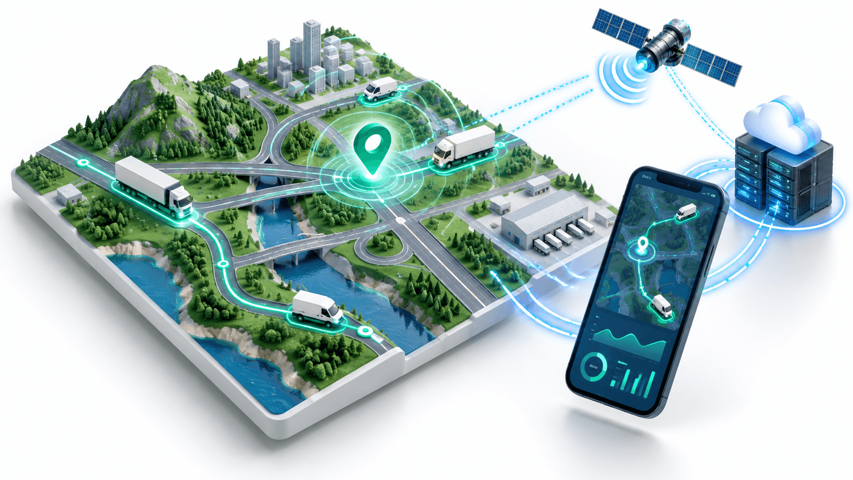
A production tracking system comprises four synchronized layers:
- The Edge Telemetry Producer (Driver App): Captures hardware GPS coordinates, applies motion filtering, and streams compact binary or JSON packets over a persistent connection.
- The Ingestion Gateway (FastAPI): Maintains thousands of concurrent WebSocket connections, authenticates incoming telemetry, and ingests telemetry data asynchronously.
- The Distributed Message Backplane (Redis Pub/Sub & Geospatial Indices): Dispatches location updates across horizontally scaled server nodes and maintains real-time geospatial caches.
- The Consumer & Dispatcher Visualizer (Client App & Admin Console): Subscribes to specific vehicle topics, receives coordinates, and smoothly interpolates marker movement and bearing rotation.
┌─────────────────────────────────────────────────────────────────────────┐
│                       The End-to-End Telemetry Pipeline                 │
├─────────────────────────────────────────────────────────────────────────┤
│                                                                         │
│   ┌───────────────────────────┐             ┌───────────────────────┐   │
│   │   Apaale Driver (Flutter) │             │ Passenger App/Web UI  │   │
│   │ - Motion-aware GPS filter │             │ - Spherical Lerp/Slerp│   │
│   │ - Offline SQLite buffer   │             │ - Decoded Polylines   │   │
│   │ - Resilient WebSocket     │             │ - Live ETAs & Bearing │   │
│   └─────────────┬─────────────┘             └───────────▲───────────┘   │
│                 │                                       │               │
│                 │ WSS Binary / JSON Packets             │ Subscribed    │
│                 │ (lat, lng, speed, bearing)            │ Vehicle Feed  │
│                 ▼                                       │               │
│   ┌─────────────────────────────────────────────────────┴───────────┐   │
│   │              FastAPI Asynchronous WebSocket Cluster             │   │
│   │ - Connection Manager & Session Authenticator                    │   │
│   │ - Non-blocking asyncio event loops                              │   │
│   │ - Wasl / TGA Regulatory Compliance Dispatcher                   │   │
│   └─────────────┬───────────────────────────────────────▲───────────┘   │
│                 │                                       │               │
│                 │ GEOADD / PUBLISH                      │ SUBSCRIBE     │
│                 ▼                                       │               │
│   ┌─────────────────────────────────────────────────────┴───────────┐   │
│   │                   Redis Distributed Cluster                     │   │
│   │ - Redis Pub/Sub Channels (`channel:fleet:vehicle_id`)           │   │
│   │ - Geospatial Index (`GEOADD fleet:active_coords`)               │   │
│   │ - Time-Series Buffer for PostGIS Permanent Archival             │   │
│   └─────────────────────────────────────────────────────────────────┘   │
└─────────────────────────────────────────────────────────────────────────┘
Battery-Conscious Mobile Geolocation in Flutter
The greatest enemy of a mobile logistics app is battery drain. A vehicle driver running GPS navigation, cellular radios, and screen rendering simultaneously will deplete a typical smartphone battery in under two hours if location hardware is polled naively.
The Motion-Aware Geofence Strategy
To maximize battery life without sacrificing positional fidelity, we implement a motion-aware state machine:
┌─────────────────────────────────────────────────────────────────────────┐
│                     Motion-Aware Geolocation States                     │
├─────────────────────────────────────────────────────────────────────────┤
│                                                                         │
│   ┌───────────────────────────┐             ┌───────────────────────┐   │
│   │      STATIONARY STATE     │  Movement   │     IN-TRANSIT STATE  │   │
│   │ - 25m stationary geofence │ ──────────► │ - Accelerometer active│   │
│   │ - GPS radio sleeps        │ Detected    │ - High-accuracy GPS   │   │
│   │ - Battery drain: < 1%/hr  │             │ - Emit every 10m/3sec │   │
│   │ - Heartbeat ping: 5 min   │ ◄────────── │ - Battery: 4-6%/hr    │   │
│   └───────────────────────────┘   Vehicle   └───────────────────────┘   │
│                                    Stops                                │
│                                                                         │
└─────────────────────────────────────────────────────────────────────────┘
- Stationary State: When the driver is idling, parked, or awaiting cargo loading, high-accuracy GPS hardware is powered down. The app establishes a circular geofence (radius ~25 meters). The GPS radio stays dormant until the device's accelerometer and gyroscope detect significant displacement.
- In-Transit State: Once displacement exceeds the stationary threshold, the engine transitions to active tracking. Instead of polling at fixed time intervals (e.g., every 1 second, which wastes resources when stuck in Riyadh rush-hour traffic), tracking is governed by a distance filter (e.g., emit updates every 10 to 15 meters) combined with a maximum time threshold (e.g., every 5 seconds).
Android Foreground Service & iOS Background Permissions
Mobile operating systems aggressively terminate background processes to conserve power. To guarantee uninterrupted telemetry:
- On Android, the driver app must launch a true Foreground Service displaying a persistent sticky notification. Without this, Android's Doze Mode will suspend network sockets within minutes.
- On iOS, the app must configure
UIBackgroundModeswithlocationand configureshowsBackgroundLocationIndicator: trueto prevent iOS watchdog terminations.
Flutter Background Telemetry Service Implementation
Here is a production-grade Dart service orchestrating location capture, filtering out inaccurate GPS multipath noise (accuracy threshold > 25 meters), and publishing location frames:
import 'dart:async';
import 'dart:convert';
import 'package:flutter/foundation.dart';
import 'package:geolocator/geolocator.dart';
import 'package:web_socket_channel/web_socket_channel.dart';

class LocationTelemetryPacket {
  final String vehicleId;
  final double latitude;
  final double longitude;
  final double speedKmh;
  final double bearingDegrees;
  final double altitude;
  final int timestampEpochMs;
  final double accuracyMeters;

  LocationTelemetryPacket({
    required this.vehicleId,
    required this.latitude,
    required this.longitude,
    required this.speedKmh,
    required this.bearingDegrees,
    required this.altitude,
    required this.timestampEpochMs,
    required this.accuracyMeters,
  });

  Map<String, dynamic> toJson() => {
    'vehicle_id': vehicleId,
    'lat': latitude,
    'lng': longitude,
    'speed_kmh': speedKmh,
    'bearing': bearingDegrees,
    'alt': altitude,
    'ts': timestampEpochMs,
    'acc': accuracyMeters,
  };
}

class TelemetryBroadcasterService {
  final String vehicleId;
  final String gatewayWebSocketUrl;

  WebSocketChannel? _channel;
  StreamSubscription<Position>? _positionSubscription;
  bool _isRunning = false;
  Position? _lastEmittedPosition;

  TelemetryBroadcasterService({
    required this.vehicleId,
    required this.gatewayWebSocketUrl,
  });

  Future<void> startTelemetryPipeline() async {
    if (_isRunning) return;

    // 1. Verify and Request System Permissions
    LocationPermission permission = await Geolocator.checkPermission();
    if (permission == LocationPermission.denied) {
      permission = await Geolocator.requestPermission();
      if (permission == LocationPermission.denied) {
        throw Exception('Location permission denied by driver.');
      }
    }

    if (permission == LocationPermission.deniedForever) {
      throw Exception('Location permission permanently denied. Enable in Settings.');
    }

    // 2. Establish Resilient WebSocket Connection
    _connectWebSocket();

    // 3. Configure Fine-Grained Location Stream
    final locationSettings = AndroidSettings(
      accuracy: LocationAccuracy.high,
      distanceFilter: 10, // Emit only when vehicle has moved at least 10 meters
      intervalDuration: const Duration(seconds: 3),
      foregroundNotificationConfig: const ForegroundNotificationConfig(
        notificationTitle: "Apaale Driver Telematics Active",
        notificationText: "Broadcasting live route telemetry to dispatch network",
        enableWakeLock: true,
      ),
    );

    _positionSubscription = Geolocator.getPositionStream(
      locationSettings: locationSettings,
    ).listen(_onPositionUpdate, onError: _onStreamError);

    _isRunning = true;
  }

  void _connectWebSocket() {
    try {
      _channel = WebSocketChannel.connect(Uri.parse(gatewayWebSocketUrl));
    } catch (err) {
      debugPrint('WebSocket connection error: $err');
    }
  }

  void _onPositionUpdate(Position position) {
    // Discard low-accuracy multipath readings (e.g. urban canyon reflections)
    if (position.accuracy > 25.0) {
      debugPrint('Discarding inaccurate GPS fix: accuracy=${position.accuracy}m');
      return;
    }

    // Prevent redundant broadcasts if stationary
    if (_lastEmittedPosition != null) {
      final metersMoved = Geolocator.distanceBetween(
        _lastEmittedPosition!.latitude,
        _lastEmittedPosition!.longitude,
        position.latitude,
        position.longitude,
      );

      if (metersMoved < 8.0 && position.speed < 1.0) {
        // Vehicle is stationary at traffic light or loading dock
        return;
      }
    }

    _lastEmittedPosition = position;

    final packet = LocationTelemetryPacket(
      vehicleId: vehicleId,
      latitude: position.latitude,
      longitude: position.longitude,
      speedKmh: (position.speed * 3.6), // Convert m/s to km/h
      bearingDegrees: position.heading,
      altitude: position.altitude,
      timestampEpochMs: position.timestamp.millisecondsSinceEpoch,
      accuracyMeters: position.accuracy,
    );

    _emitPacket(packet);
  }

  void _emitPacket(LocationTelemetryPacket packet) {
    if (_channel != null) {
      final jsonPayload = jsonEncode(packet.toJson());
      _channel!.sink.add(jsonPayload);
    }
  }

  void _onStreamError(dynamic error) {
    debugPrint('Position stream encountered error: $error');
  }

  Future<void> stopTelemetryPipeline() async {
    await _positionSubscription?.cancel();
    await _channel?.sink.close();
    _isRunning = false;
  }
}
Scalable Ingestion Gateway: FastAPI WebSockets and Redis Pub/Sub
When scaling a fleet platform to 10,000 active delivery vans and rideshare vehicles broadcasting telemetry every 3 seconds, the backend receives roughly 3,333 packets every second.
Traditional REST request-response cycles fail here:
- Establishing TLS handshakes for 3,333 HTTP requests per second incurs massive CPU overhead.
- Direct database writes at this rate saturate PostgreSQL connection pools and write IOPS.
FastAPI paired with uvicorn and Redis Pub/Sub provides an optimal asynchronous solution. A single persistent WebSocket connection keeps the socket open, streaming tiny JSON or binary payloads directly into memory.
┌─────────────────────────────────────────────────────────────────────────┐
│                    FastAPI WebSocket & Redis Architecture               │
├─────────────────────────────────────────────────────────────────────────┤
│                                                                         │
│   FastAPI Node 1                           FastAPI Node 2               │
│   ┌───────────────────────────┐            ┌───────────────────────────┐│
│   │ Driver 101 WebSocket      │            │ Passenger 504 WebSocket   ││
│   │ [POSTS lat: 24.71, lng: 46.67]         │ [Listening for Driver 101]││
│   └─────────────┬─────────────┘            └─────────────▲─────────────┘│
│                 │                                        │              │
│                 │ PUBLISH fleet:vehicle:101              │ SUBSCRIBE    │
│                 ▼                                        │              │
│   ┌──────────────────────────────────────────────────────┴─────────────┐│
│   │                    Redis Message Broker                            ││
│   │  - Channel: `fleet:vehicle:101`                                    ││
│   │  - Geospatial: `GEOADD active_fleet 46.67 24.71 vehicle_101`       ││
│   └────────────────────────────────────────────────────────────────────┘│
└─────────────────────────────────────────────────────────────────────────┘
FastAPI Production Telemetry Ingestion Router
Here is the asynchronous Python backend server managing vehicle connections, parsing telemetry frames, and publishing them to Redis:
import asyncio
import json
import logging
from typing import Dict, Set
from fastapi import FastAPI, WebSocket, WebSocketDisconnect, Query, status
from pydantic import BaseModel, Field
import redis.asyncio as aioredis

logger = logging.getLogger("telematics_gateway")
app = FastAPI(title="Apaale Fleet Telemetry Gateway")

# Distributed Redis Cluster URL
REDIS_URL = "redis://localhost:6379/0"
redis_client: aioredis.Redis = None


@app.on_event("startup")
async def startup_event():
    global redis_client
    redis_client = aioredis.from_url(
        REDIS_URL,
        encoding="utf-8",
        decode_responses=True
    )
    logger.info("Connected to Redis Pub/Sub backbone.")


@app.on_event("shutdown")
async def shutdown_event():
    await redis_client.close()


class TelemetryFrame(BaseModel):
    vehicle_id: str
    lat: float = Field(..., ge=-90.0, le=90.0)
    lng: float = Field(..., ge=-180.0, le=180.0)
    speed_kmh: float
    bearing: float
    alt: float
    ts: int
    acc: float


class FleetConnectionManager:
    """Tracks active driver and listener WebSocket sockets."""
    def __init__(self):
        self.active_drivers: Dict[str, WebSocket] = {}
        self.vehicle_subscribers: Dict[str, Set[WebSocket]] = {}

    async def register_driver(self, vehicle_id: str, websocket: WebSocket):
        await websocket.accept()
        self.active_drivers[vehicle_id] = websocket

    def unregister_driver(self, vehicle_id: str):
        if vehicle_id in self.active_drivers:
            del self.active_drivers[vehicle_id]


manager = FleetConnectionManager()


@app.websocket("/ws/v1/telemetry/driver/{vehicle_id}")
async def driver_telemetry_ingress(
    websocket: WebSocket,
    vehicle_id: str,
    token: str = Query(...)
):
    """
    High-throughput ingestion socket for delivery and rideshare drivers.
    """
    # 1. Authenticate Token (JWT / API Key check)
    # verify_driver_token(vehicle_id, token)

    await manager.register_driver(vehicle_id, websocket)
    logger.info(f"Driver {vehicle_id} established telemetry stream.")

    try:
        while True:
            raw_text = await websocket.receive_text()
            try:
                data = json.loads(raw_text)
                frame = TelemetryFrame(**data)
            except Exception as parse_err:
                logger.warning(f"Malformed telemetry packet: {parse_err}")
                continue

            # 2. Update Redis Geospatial Index (Allows rapid radius searches)
            await redis_client.geoadd(
                "active_fleet_locations",
                (frame.lng, frame.lat, frame.vehicle_id)
            )

            # 3. Broadcast to Real-Time Pub/Sub Channel for listeners
            channel_name = f"fleet:telemetry:{frame.vehicle_id}"
            await redis_client.publish(channel_name, raw_text)

            # 4. Optional: Push to Kafka / RabbitMQ for Wasl TGA government sync

    except WebSocketDisconnect:
        manager.unregister_driver(vehicle_id)
        logger.info(f"Driver {vehicle_id} disconnected.")


@app.websocket("/ws/v1/telemetry/subscribe/{vehicle_id}")
async def customer_telemetry_egress(websocket: WebSocket, vehicle_id: str):
    """
    Outbound socket for passenger apps and dispatch monitoring screens.
    """
    await websocket.accept()
    pubsub = redis_client.pubsub()
    channel_name = f"fleet:telemetry:{vehicle_id}"
    await pubsub.subscribe(channel_name)

    try:
        while True:
            message = await pubsub.get_message(
                ignore_subscribe_messages=True,
                timeout=1.0
            )
            if message and message["type"] == "message":
                await websocket.send_text(message["data"])
            await asyncio.sleep(0.01)
    except WebSocketDisconnect:
        await pubsub.unsubscribe(channel_name)
        await pubsub.close()
Smooth Map Visualization in Flutter: Marker Interpolation and Bearing
The most visible sign of an unpolished tracking app is marker jumping.
When telemetry arrives every 3 to 5 seconds, placing the vehicle marker directly at the newest LatLng causes it to abruptly teleport across the street. Furthermore, if the icon orientation does not match the road's true curvature, the vehicle appears to drift sideways like a crab.
Problem: Naive Coordinate Snapping (Jerky Teleportation)
Position A ──(3-sec pause)──► [Teleports to Position B] ──► [Teleports to C]

Solution: Spherical Linear Interpolation (Lerp) with Bearing Slerp
Position A ──(Smooth 60fps AnimationController over 3000ms)──► Position B
Spherical Linear Interpolation (Lerp)
To achieve the seamless glide popularized by Uber and Careem, the Flutter client must animate the marker from its current position to the target coordinates using an AnimationController synchronized to the expected telemetry arrival window.
Here is the mathematical interpolation logic and reusable controller:
import 'dart:math' as math;
import 'package:flutter/material.dart';
import 'package:google_maps_flutter/google_maps_flutter.dart';

class SmoothMarkerAnimator {
  final TickerProvider vsync;
  final Function(LatLng interpolatedPosition, double interpolatedBearing) onFrame;

  AnimationController? _controller;
  Animation<double>? _animation;

  LatLng _startPosition = const LatLng(0, 0);
  LatLng _targetPosition = const LatLng(0, 0);
  double _startBearing = 0.0;
  double _targetBearing = 0.0;

  SmoothMarkerAnimator({required this.vsync, required this.onFrame});

  void animateTo({
    required LatLng newPosition,
    required double newBearing,
    Duration duration = const Duration(milliseconds: 3000),
  }) {
    _controller?.dispose();

    _startPosition = _targetPosition;
    _targetPosition = newPosition;

    _startBearing = _targetBearing;
    _targetBearing = _normalizeBearingDifference(_startBearing, newBearing);

    _controller = AnimationController(vsync: vsync, duration: duration);
    _animation = CurvedAnimation(parent: _controller!, curve: Curves.linear);

    _controller!.addListener(() {
      final t = _animation!.value;

      // Linear interpolation for latitude and longitude
      final currentLat = _lerpDouble(_startPosition.latitude, _targetPosition.latitude, t);
      final currentLng = _lerpDouble(_startPosition.longitude, _targetPosition.longitude, t);

      // Interpolate bearing angle smoothly
      final currentBearing = _lerpDouble(_startBearing, _targetBearing, t) % 360;

      onFrame(LatLng(currentLat, currentLng), currentBearing);
    });

    _controller!.forward();
  }

  static double _lerpDouble(double a, double b, double t) {
    return a + (b - a) * t;
  }

  /// Ensures rotation takes the shortest circular arc (e.g. 350 deg to 10 deg)
  static double _normalizeBearingDifference(double start, double target) {
    double diff = (target - start) % 360;
    if (diff > 180) diff -= 360;
    if (diff < -180) diff += 360;
    return start + diff;
  }

  void dispose() {
    _controller?.dispose();
  }
}
Integrating with Google Maps in Flutter
Inside your customer-facing tracking screen:
class LiveTrackingMapScreen extends StatefulWidget {
  final String vehicleId;
  const LiveTrackingMapScreen({super.key, required this.vehicleId});

  @override
  State<LiveTrackingMapScreen> createState() => _LiveTrackingMapScreenState();
}

class _LiveTrackingMapScreenState extends State<LiveTrackingMapScreen>
    with TickerProviderStateMixin {
  GoogleMapController? _mapController;
  late SmoothMarkerAnimator _markerAnimator;

  LatLng _vehiclePosition = const LatLng(24.7136, 46.6753); // Riyadh default
  double _vehicleBearing = 0.0;
  BitmapDescriptor? _carIcon;

  @override
  void initState() {
    super.initState();
    _markerAnimator = SmoothMarkerAnimator(
      vsync: this,
      onFrame: (pos, bearing) {
        setState(() {
          _vehiclePosition = pos;
          _vehicleBearing = bearing;
        });
      },
    );

    _loadCustomMarkerIcon();
    _subscribeToLiveVehicleTelemetry();
  }

  Future<void> _loadCustomMarkerIcon() async {
    _carIcon = await BitmapDescriptor.fromAssetImage(
      const ImageConfiguration(size: Size(48, 48)),
      'assets/icons/delivery_car_top_down.png',
    );
  }

  void _subscribeToLiveVehicleTelemetry() {
    // In production, connect to the FastAPI WebSocket channel
    // Whenever a new packet arrives:
    // _markerAnimator.animateTo(newPosition: packet.coords, newBearing: packet.bearing);
  }

  @override
  Widget build(BuildContext context) {
    return Scaffold(
      body: GoogleMap(
        initialCameraPosition: CameraPosition(
          target: _vehiclePosition,
          zoom: 16.0,
        ),
        onMapCreated: (controller) => _mapController = controller,
        markers: {
          Marker(
            markerId: const MarkerId('active_vehicle'),
            position: _vehiclePosition,
            rotation: _vehicleBearing,
            anchor: const Offset(0.5, 0.5),
            flat: true, // Crucial: aligns marker flat to road plane during map tilts
            icon: _carIcon ?? BitmapDescriptor.defaultMarker,
          ),
        },
      ),
    );
  }

  @override
  void dispose() {
    _markerAnimator.dispose();
    super.dispose();
  }
}
Managing Gulf Desert Highway Drops: Offline Buffering and Sync
Commercial transport in Saudi Arabia and Oman frequently traverses expansive desert highways (such as Highway 65 between Riyadh and Buraidah, or Route 31 through the Dhofar desert in Oman). In these expanses, mobile cellular towers can be spaced 30 kilometers apart, leading to intermittent connection dropouts lasting 5 to 20 minutes.
If an in-transit driver app simply drops telemetry readings during a network disconnect:
- Fleet managers lose audit trails.
- Speeding violations and harsh braking events in remote areas escape detection.
- Government compliance systems (Wasl) log penalties for discontinuous vehicle logs.
The Client-Side Offline FIFO Queue
To guarantee zero telemetry loss, the driver app implements a persistent local FIFO (First-In, First-Out) database buffer powered by SQLite (sqflite) or Hive:
┌─────────────────────────────────────────────────────────────────────────┐
│                      Offline Telemetry Buffer Pipeline                  │
├─────────────────────────────────────────────────────────────────────────┤
│                                                                         │
│   New GPS Position Read                                                 │
│            │                                                            │
│            ▼                                                            │
│   Is WebSocket Connected?                                               │
│      ├─── YES ───► Transmit frame immediately over WebSocket             │
│      │                                                                  │
│      └─── NO  ───► Insert frame into Local SQLite FIFO Table            │
│                    (Buffered with accurate GPS UTC timestamp)           │
│                           │                                             │
│                           ▼                                             │
│                    Network Restored!                                    │
│                           │                                             │
│                           ▼                                             │
│                    Drain FIFO queue in chunks of 50 packets             │
│                    with 200ms backpressure pauses                       │
│                                                                         │
└─────────────────────────────────────────────────────────────────────────┘
SQLite Schema for Buffered Packets
CREATE TABLE telemetry_offline_buffer (
    id INTEGER PRIMARY KEY AUTOINCREMENT,
    vehicle_id TEXT NOT NULL,
    latitude REAL NOT NULL,
    longitude REAL NOT NULL,
    speed REAL NOT NULL,
    bearing REAL NOT NULL,
    recorded_at_epoch INTEGER NOT NULL,
    is_synced INTEGER DEFAULT 0
);
When network restoration is detected by connectivity_plus, the app triggers a draining task that transmits buffered records with their original historical timestamps. The FastAPI backend detects these historical packets and routes them directly to permanent storage without broadcasting them as live locations to waiting passengers.
Regulatory Compliance: Saudi Wasl (TGA) Integration
In Saudi Arabia, commercial delivery and passenger transport platforms are legally required to integrate with Wasl (operated by Elm on behalf of the Transport General Authority).
┌─────────────────────────────────────────────────────────────────────────┐
│                       Wasl Compliance Requirements                      │
├────────────────────────────────┬────────────────────────────────────────┤
│ Requirement                    │ Technical Implementation               │
├────────────────────────────────┼────────────────────────────────────────┤
│ Driver & Vehicle Verification  │ Validates Iqama / National ID,         │
│                                │ Vehicle Sequence Number, and License.  │
├────────────────────────────────┼────────────────────────────────────────┤
│ Live Periodic Location Ping    │ Telemetry pings transmitted every      │
│                                │ 15 - 30 seconds during active trips.   │
├────────────────────────────────┼────────────────────────────────────────┤
│ Waybill Registration           │ Electronic bill of lading registered   │
│                                │ prior to dispatching cargo.            │
└────────────────────────────────┴────────────────────────────────────────┘
Our FastAPI ingestion service isolates Wasl integration into an asynchronous background worker (using Celery or ARQ). When a driver's trip is marked active, the telemetry engine forwards location packets directly to Wasl's REST endpoints, insulating mobile drivers from government server timeouts.
Summary Checklist for Fleet Telemetry Architecture
- Motion Awareness: Use geofencing and distance filters; avoid continuous 1-second GPS polling to protect battery life and prevent thermal overheating in desert climates.
- Foreground Services: Enforce native Android foreground services with sticky notifications and iOS background location modes to prevent OS task killing.
- Asynchronous WebSockets: Ingest telemetry using FastAPI and Redis Pub/Sub; decouple high-frequency socket writes from heavy relational database transactions.
- Smooth Map Rendering: Use spherical interpolation (
lerp) and arc-normalized bearing adjustments to eliminate marker jumping. - Offline Buffering: Buffer telemetry frames in an offline SQLite FIFO queue during remote highway cellular drops, draining automatically upon reconnection.
Conclusion
Engineering a production-grade real-time GPS fleet tracking system requires a delicate balance between battery efficiency on mobile hardware, low-latency asynchronous socket multiplexing on the server, and fluid visual smoothing on the frontend interface.
Whether you are building on-demand delivery apps, freight transportation management systems, or ridesharing platforms like Apaale, adopting motion-aware edge filtering, Redis Pub/Sub backplanes, and client-side interpolation transforms raw telemetry into an effortless, battery-conscious user experience.
Ready to build a real-time fleet tracking or logistics platform? I architect and deliver complete production telemetry systems from battery-optimized Flutter mobile apps to high-throughput FastAPI WebSocket clusters and distributed mapping workflows. Book a meeting to discuss your product architecture.
Interested in working together?
Let's discuss your project and explore how I can help bring it to life.